 01
01Survey and Mapping
High-accuracy topographic, cadastral, and engineering mapping for planning and execution.
Services
Our service lines are designed to support the full lifecycle of geospatial projects, from field deployment to decision-ready output.
01High-accuracy topographic, cadastral, and engineering mapping for planning and execution.
 02
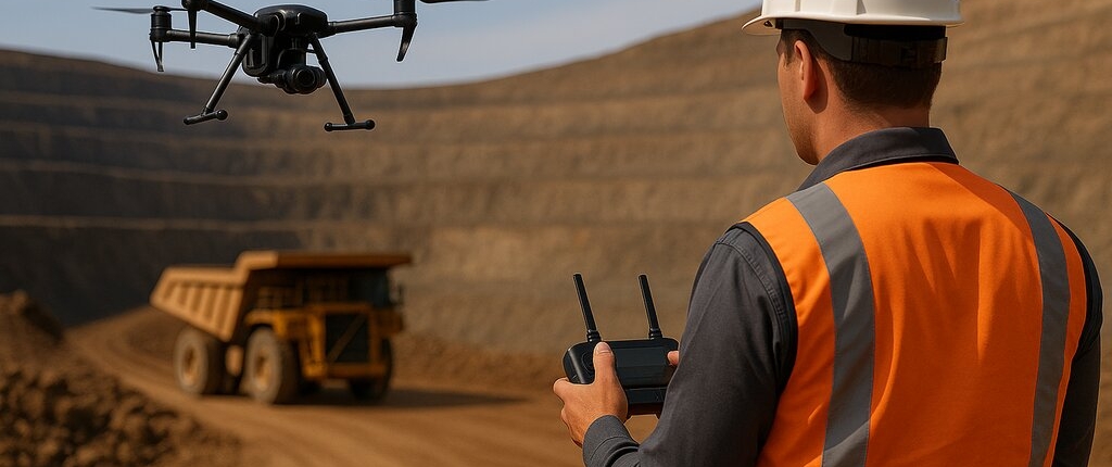
02Aerial and ground inspection workflows for utilities, infrastructure, and industrial assets.
 03
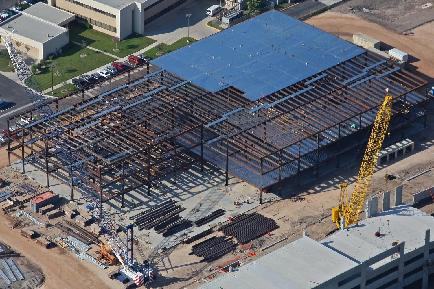
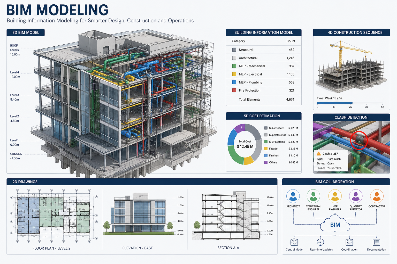
03Point cloud processing, volumetrics, and model generation for analytics and reporting.
 04
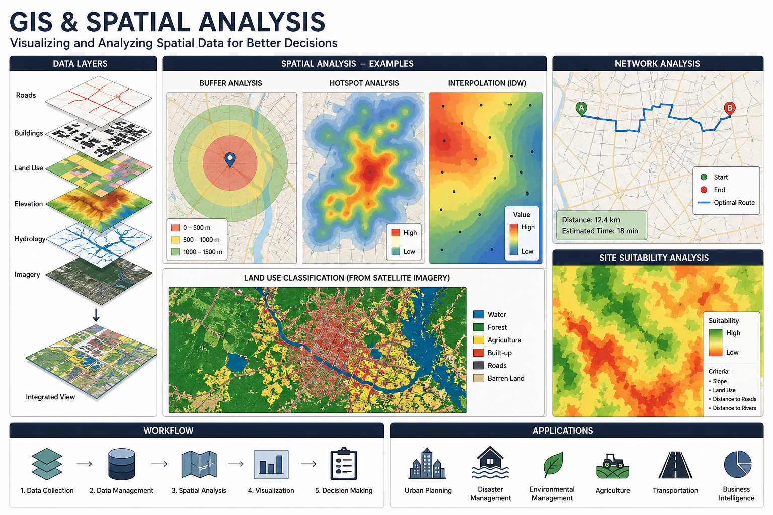
04Custom GIS layers, change detection, and geospatial intelligence dashboards for operations.
 05
05Integrated geophysical interpretation and subsurface context for better project decisions.
 06
06Capability development for client teams in data collection, quality control, and utilization.
Ready to Get Started?
Tell us about your project scope and goals. We'll get back to you with a practical engagement plan tailored to your needs.
Book a ConsultationSee how our solutions combine imagery, AIS, and operational datasets to produce measurable outcomes across infrastructure, maritime, and energy operations.
View Case Studies